
|
| A Combs &c. Research Report |
|---|
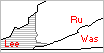 SW Virginia 1792 |
Combs &c. Families of Russell County, VA Land Records | 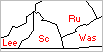 SW Virginia 1814 |
|---|
| Meet
Our Families (Background) |
Visit Our Neighborhoods (Land Records) |
Honor
Our Ancestors (Cemeteries) |
|---|---|---|
| 1786-1815
(Records) |
1816-1850
(Records) |
1851-
(Records) |
| Location | & the Neighbors |
|---|---|
| Carr's Cr., Big Moccasin, North Fork Holston River | Alexander & Dicey PERRY Combs? |
| Cedar Creek, South Side of Clinch River, Upper Russell | Counts, Gilmore, Smith |
| Weavers Creek, Clinch River, Upper Russell | William & Anna THOMPSON Combs and Crabtree. |
| Combs Farm, Dorton's Fort, Copper Creek, Clinch River | Not Known |
| Crabtree Br., Big Moccasin, North Fork Holston River, Lower Russell | William & Seth STACY Combs, Sr. and Cody, Cornett, Davidson, Farris, Loveall, Osbourne, Thompson, Turner, White |
(Russell Co VA, possibly later in Scott Co)
From Combs Researcher Sue Elfving: William HOUSTON, James DAVISON I, John FRAZIER, and Jonathan WOOD were original neighbors owning land 12 miles NE of what is now Gate City and near the current Russell/Scott Co. line. Then, HOUSTON, FRAZIER, WOOD, and James DAVISON II moved down Moccasin and obtained land about 7-8 miles NE of Gate City. The location of the land these four originally settled on remained in their possession. William HOUSTON built a fort on his original land to protect him and his neighbors from the Indian raids which have been well documented. The land that HOWERTON purchased (Russell Co, VA DB2:44-5) of John and Mary FRAZIER bordered that of Elisha FARIS. Elisha and some members of his family were killed by the Indians as were some members of John FRAZIER'S family.
According to The Combes Genealogy…, "the surveyor's books, land entry books and deed books list William Combs five times between 17951815, on Moccasin Creek and on Big Moccasin Creek... From the old land patents it appears that some of William's land was in the present Washington County..." (For his land to have been in Washington Co, it would have to have been further northeast). Not all records for William Combs have been extracted yet. Only one early patent has been found thus far, although it refers to an earlier patent ("old survey"). The 1815 record, for example, is still needed.
William Combs (Sithe STACY) to William HOURTON a.k.a. HOWERTON.
William Combs - 100 ac - 2 treasury warrants 662 & 663 dated September 6, 1796 for 50 ac each - adjoining a survey of said Combs - crossing Mocarson Creek twice
Wm. Combs. 100 acres. Russell Co. James Monroe Esquire
Governor of the Commonwealth of Virginia to all to whom these presents shall
Come Greeting Know Too That by virtue of two Exchanged Land Office Treasury
Warrants numbers six hundred and sixty two and six hundred and sixty three,
both issued the sixth day of September one thousand seven hundred and ninety
six, There is Granted by the said Commonwealth unto William Combs A Certain
tract or parcel of land Containing one hundred acres by survey bearing date
the -- thirtieth day of January one thousand seven hundred and ninety eight,
lying and being in the County of Russell adjoining a survey of the said Combs'S
and bounded as followeth to wit, beginning at three white oaks corner to
said Combs thence South nineteen degrees East ninety six poles crossing
a branch to a black oak and two -- hickory saplings on the West side of a spur
North sixty nine degrees East one hundred and sixty eight poles to two hickories
and a white oak on the east side of a spur North twenty one degrees West ninety
six poles to three white oak saplings another corner to said Combs and
with his line south sixty nine degrees West one hundred and sixty six poles
crossing Mockerson Creek twice to the beginning with its appurtenances
to have and to hold the said tract or parcel of land with its appurtenances
to the said William Combs and his heirs forever, In witness the said
James Monroe esquire Governor of the Commonwealth of Virginia hath hereunto
set his hand and caused the lesser seal of the said Commonwealth to be affixed
at Richmond on the nineteenth day of December in the year of our Lord one thousand
eight hundred and of the Commonwealth the twenty fifth.
s/James Monroe
(Transcribed by Combs Researcher C. Hammett from /combs/graphics/46-569.gif (originally VSLA))
William Combs & Sytha his wife to William HOURTON, all
of Russell. $60. 100 a. in Russell Co on Big Mockerson Cr. waters
of Northfork of Holsten and joining the old survey of the sd. Combs and
bounded corner to the sd. Combs... another corner to sd. Combs...
crossing Mockerson Cr. which land was granted sd. Combs by patent
bearing date 20 Jan 1798.
s/William (his X mark) Combs, Sytha (her + mark) Combs.
Wits; Isaac O'DONOLD & John SMITH and continued for further proof.
Ack./Rec. Aug Court 1805 on Oath of John WELLS.
William Combs and Sytha his wife of Russell County to William HOWERTON, 100a on Big Mockerson Creek, joining an old survey of said Combs …beg at 3 white oaks, corner to said Combs……….. another Combs corner……. with his line crossing Mockerson Creek twice to the beginning…granted by patent to Combs dated 1/20/1798.
(Abstracted by Combs Researcher Sue Elfving)
A Washington Co. survey for John FRAZIER, by virture of a certificate from the Commission for the District of Washington and Montgomery Counties… for 236a lying on both sides of Mockison Creek… beg at a white oak corner to Elisha FARIS land…… A paragraph dated 8/8/1781 added to the bottom of the survey stated John FRAZIER was entitled to 400 acres by settlement in the year 1774, lying below that of Rubin PRICE upon Mockinson Creek.
(Combs Researcher Sue Elfving)
SE Note: This record places Rubin PRICE (future husband of Dolly CODY) in Russell Co. before 8/8/1781. Rubin PRICE later obtained a 50 acre grant per Land Office Treasury Warrant #19218 with survey dated 3/21/1786 (p.327).
Ed Note: By 1812 Reuben PRICE (h/o Dolly CODY), David THOMPSON (h/o Nancy CODY), James TATE (h/o Ruth DAVIDSON), Champ FARIS and others on the 1812 Warren Co, TN Tax Return of James Cooper.
John FRAZER. 236 a. on both sides of Mockison Creek a branch of the north fork of Holstein
(VSLA Card Index)
Indent John & Mary FRAZER to William HOWARTON, all of Russell
Co, VA, L80, 236 acres, Morqueson Creek, branch of North fork
of Holstein in Russell Co bounded corner to Elisha FARRISSES Land, spurr
of Clinch Mountain, land granted to sd. John FRAZIER [sic] by patent of
03 Jun 1788.
s/John FRAZER, Mary FRAZER.
Wits: None. Mary, his wife privily examined
(Abstracted by Combs Researcher C. Hammett from "Russell Co VA Deed Book 2, 1795-1798," Tom Colley, Iberian Publishing Company, Athens, GA, 1995)
Indent William HOURTON to William Combs, both of Russell
Co, VA. $30. 30 acres m/l adj. William Combs on Big Mochason
Creek, land purchased by said HOURTON of John FRAZIER by patent dated 03
Jun 1788.
s/William HOURTON
No Wits.
(Abstracted by Combs Researcher C. Hammett from "Russell Co VA Deed Book 3, 1798-1806," Tom Colley, Iberian Publishing Company, Athens, GA, 1995)
William HOWERTON of Russell Co. to William Combs of same, land adjacent him containing 30 acres on Big Mockason…N100…30poles…land that was purchased by William HOWERTON of John FRAZIER which had been granted to FRAZIER by patent dated 6/3/1788
(Abstracted by Combs Researcher Sue Elfving)
William Combs to William HOWERTON
Note: This tract and the preceding may have been part of an exchange of lands between William Combs and William HOWERTON aka HOURTON. This land may have been part of the "old survey."
Indent: William Combs to William HOURTON, both of Russell
Co, VA. $200. 30 acres m/l north side of Mockerson Creek a branch
of the north fork of Holston bounded... above ford of Creek by Champion FARISES,
William HOURTON'S spring.
s/William Combs.
No Wits. No relinquishment noted.
(Abstracted by Combs Researcher C. Hammett from "Russell Co VA Deed Book 3, 1798-1806," Tom Colley, Iberian Publishing Company, Athens, GA, 1995)
William Combs of Russell Co. to William HOWERTON of Russell Co., 30 acres on the north side of Mockason Creek beginning at or above the ford at the creek by Champion FARRISES on a conditional line…..by William HOWERTON's spring…..signed William Combs his seal and acknowledged by William Combs.
(Abstracted by Combs Researcher Sue Elfving)
John FRAZER-FRAZIER to William LAWSON
John FRAZER. N. side of Clinch and S. side of Mockison Creek
Indent: John FRAZIER and Mary his wife to William LAWSON,
all of Russell Co. $250. 155 acres. on big Mockason Creek waters
of N. Fk. Holston R. and known by the name of the little Valley below
Wm. HOUSTON'S and bounded... upper end of little Valley and a bout half a mile
below Wm. HOUSTON"S plantation ... foot of Clinch Mountain ... land
granted unto sd. FRAZIER by patent 02 Jun 1788.
s/John FRAZER, Mary FRAZER.
Wits: William (his D mark) TURNER, William (his X mark) HOUSTON, William LAWSON,
Junr.
Ack/Rec: 26 Mar 1799.
John WOODS (75 a) to Jonathan WOOD and (75 & 75 a) to Vincent BENHAM and (325 a) to William WELLS and (144 a) to John WELLS (Total: 694)
John WOODS - 600 ac - 2 entries on part of 3 Treasury Warrants: 200 ac by 11962 dated May 10, 1782; 200 ac by 16602 dated May 27, 1783 & 200 ac by 3323 dated March 3, 1780 - on the waters of Mocason Creek - corner tract of land known by the name of FRAZIERS cane brak - near the bank of Mocason Creek - corner William LAWSON - spur of Clinch Mountain
Indent: John WOOD to Jonathan WOOD, both of Russell. $15
current money. 75 a m/l on Big Mocheson Cr. it being part of a larger tr. granted
to sd. John WOOD by pat. dated 31 Dec 179 and bounded corner to Vincine BENHAMS
land, clifft of Mockeson Cr.
s/John WOOD.
Wits: None.
Ack/Rec: Feb 1801 Ct.
Indent: John WOOD of Russell VA to Vincent BENHAM of Washington
Co VA. 12 pds 10 sh curr. money. 75 acres m/l on the waters of Big
Mockeson Cr. part of larger tract granted to sd. John WOOD from Commonwealth
pat. dated 31 Dec 1799 and bounded: corner to William LAWSONS land... spur of
Clinch Mountain.
s/John WOOD
Wits: None
Ack/Rec: Reb 1801 court.
Indent: John WOOD of Russell VA to Vincent BENHAM of Washington
Co VA. 12 pds 10 sh curr. money. 75 acres m/l on the waters of Big
Mokeson Cr. part of larger tract granted to sd. John WOOD from Commonwealth
pat. dated 31 Dec 1799 and bounded: crossing sd. creek, line of William LAWSONS
land...
s/John WOOD.
Wits: None.
Ack/Rec: Reb 1801 court.
John & Nancy WOOD to William WELLS
Indent: John WOOD & Nancy his wife to William WELLS,
all of Russell VA, L60 current. 325 a. m/l on Big Mockeson Cr. part of a larger
tract granted to sd. John WOOD from Commonwealth pat. dated 31 Dec 1799
and bounded: near the bank of Mockerson Cr. Clift of sd. Cr.
s/John WOOD, Nancy WOOD.
Wits: None.
Ack/Rec: Reb 1801 court. "At May Court 1801.
This indent. was again prd. in Court and Nancy WOOD being privily examined as the law ___ ? __ Ordered that her ackxment be now with the dded."
John WOOD to William WELLS to Avery KESSEE
18 Feb 1806 Russell Co VA DB3:713.
Indent: William WELLS & Jemima his wife to Avery KESSEE, all of Russell. $500. 150 acres. m/l sit. on Big Mockerson Cr. waters of n. fork of Holston R., lands deeded from John WOOD to sd. William WELLS, dated 31 Dec 1799, and bounded James QUILLEN cond. line, old line to the Stony Ridge. cond. line between the sd. William WELLS and James BRISTOW.
s/Willill [sic] WELLS, Jemima (X) WELLS.
Wit: William (+) HOURTON Isaac O'DONALD, William LAWSON.
Ack. Mar Court 1806 on Oaths of [above wits]
John WOOD to William WELLS to James QUILLEN
Indent: William WELLS & Jemima his wife to James QUILLEN,
all of Russell. $130. 30 acres m/l on big Mockerson Creek waters
of n fork of Holston River, land deeded by John WOOD to sd. William WELLS 31
Dec 1799 and bounded cond. line made bet. William WELLS and Taug. [Teague] QUILLEN.
s/William WELLS, Jemima (X) WELLS.
Wits: William (X) HOURTON, William LAWSON, Isaac O'DONALD.
Ack. Mar Court 1806 on Oaths of [above wits]
John WOOD to John WELLS
Indent: John WOOD and Nancy his wife to John WELLS, all
of Russell Co. $100. 144 acres. Both sides of the Stony Ridge Waters
of Big Mochason Creek and bounded... head of the Big Spring... land granted
to sd. John WOOD by patent 31 Dec 1799.
s/John WOOD, Nancy WOOD.
Wit: Peter (his p mark) McINTOSH, William WELLS, Daniel DAVISON.
Ack/Rec: 26 Jan 1802 on oaths of [above wits] Nancy, wife of John WOOD being
first privily exam.
Elisha & Edward FARRIS to James OSBORNE to William TURNER
Elisha FARIS. 116 acres, both sides of Mocqueson Creek a br. of n fork of Holston river bounded by north side of Crabtrees branch.
Edward FARIS, Admin. of est. of Elisha FARIS, dicesed [sic] to
James OSBORNE, both of Russell Co. L150 current money (paid until sd Elisha
FARIS in his life Time) 116 a. granted sd. Elisha FARIS by patent dated
14 Jun 1787, Russell Co on both sides of Mocqueson Creek a br. of n fork
of Holston river bounded by north side of Crabtrees branch.
s/Edward FARIS.
Wits: None.
No date rec. given.
James OSBAND [sic] to William TURNER, both of Russell. L50. 116
acres gr. unto sd. James OSBAND by deed dated 07 Sep 1791, both sides of
Mockerson Creek a br. of the N. fk of Holston bounded north side of Crabtrees
Branch.
s/James OSBAND.
Wits: None.
William TURNER to Champ & Catherine FARRIS to William & Jemima WELLS to William HOWERTON
William TURNER to Champain FARIS, both of Russell. L100, 60 a.,
m/l. Granted to William TURNER by deed dated 24 Aug 1794. Land in Russell Co
on both sides of Maugason Cr, br of N. fork of Holston Riv. Bounded:
North side of Crabtree br. Cond. line mark'd to creek [tree?] across the bent
by William TURNER & Joseph BLAIR, deceased.
s/William (his O mark) TURNER.
Wits: James DAVISON, Simon STACY, Stephen HOGG, James HOGG, Abraham CHILDERS.
Ack./Rec. May Ct. 1798 on oaths of James DAVISON, Simon STACY & James HOGG
Indent. Champion FARIS & Kaitrin his wife to William WELLS,
all of Russell. $866.2/3. 60 acres. m/l which land was conveyed by Deed
from William TURNER to sd. Champ FARIS by Deed dated 24 Aug 1794. Lying in Russell
Co on both sides of Big Mockeson Cr., a br. of the N. fork of Holston
River and bounded... North side of Crabtree branch, crossing the creek,
cond. line made by William TURNER and Joseph BLAIR deceased.
s/Champion FARIS, Catherine [sic] FARIS
Wits: None
Ack/Rec: Aug 1804 Ct. Catherine his wife being privily examined...
William WELLS & Jemima his wife to William HOURTON, all of
Russell. $733.1/3. 60 acres m/l, land deeded from Champion FARIS to William
WELLS 24 Aug 1804 sit. on big Mockerson Creek waters of the North fork
of Holston River and Bounded n. side of Crabtree br... William Combs
line.
s/William WELLS, Jemima (X) WELLS
Wit: William LAWSON, Isaac O'DONALD, Avery (X) KESSEE
Ack./Rec. Mar 1806 Court on Oaths of [above wits.]
(SW: HOWERTON)
Champ FARRIS to John WHITE
1783/01/23. Washington Co VA Survey
Champion FARRIS. 50 a. south side of Moccasin Creek
1793 Oct 10 -28 Jan 1794 (Russell Co., VA Deed Book 1, pp 305-6)
Indenture between Champain FARIS and John WHITE both of Russell Co., VA £40 lawful money of the State of Virginia, land in Russell Co on Big Moqueson Creek on the north side [sic] of the creek containing 50 acres beginning at the mouth of the first branch below James DAVIDSON'S Mill House branch, the dug bank, towards Copper Creek Ridge with James OSBORNS line.
Signed: Champain (his X Mark) FARIS.
Witnesses: John WOOD, James OSBORN, John (his + mark) STACEY.
Recorded 28 Jan 1794
proven on Oaths of John WOOD & James OSBORN.(Combs-Cody Researcher George Baumbach)
25 Aug 1795 Russell Co VA DB3:30
Indent: John WHITE to William STRONG, both of Russell Co VA. L50. 50 a. land in Russell on big Morqueson Creek on the No. side of creek containing 50 a. m/l Beg. mouth of the first br. below. Jas. DAVIDSON Still House branch and running down the creek... dug bank toward the Copper Creek Ridge with James OSBORNS line.
William & Jane CALLAHAN Strong to John DAVISON
Indent: William STRONG & Jane his wife to John DAVISON, all of Russell. L100, land in Russell on Big Mockeson Cr. a north Br. of the N. F of Holston R. cont. 90 acres, m/l being a part of a larger tract granted to George KEZEE by this Commonw. by pat. dated 23 Jul 1788 and bounded: bank of the creek.
William & Susan TURNER to William HOWERTON
Indent: William TURNER and Susan his wife of Knox Co
KY to William HOURTON-HOWERTON of Russell Co. $493. 70 ac m/l in
Russell Co on both sides of Mockerson Cr., a br. of the north fork of
Holston River, beg. at a clift of rocks by the cr. on one of the conditional
lines near David THOMPSON'S line, thence North, by a sink hole, crossing the
creek, to a cedar clift to the creek, then down the cr. to the cond. line, thence
crossing the cr., thence with a cond. line made bet. sd. William TURNER and
Joseph BLAIR to the Beg.
s/William (his X mark) TURNER.
Wit: Jno. HENRY, Wm. HOUTON [sic], Nathan HOURTON
Ack./Rec. 05 Sep 1809. William TURNER & Susanna his wife to
William HOWERTON [sic]
proven in court by oaths of John HENRY, William HOURTON [sic], and Nathan HOURTON.
David & Nancy CODY Thompson to John GODSEY
David THOMPSON - 100 ac - part Treasury Warrant 1951 dated December 18, 1781 - on Big Mocason Creek - corner Samuel CORNETT - corner William TURNERS survey - by a road
Indenture between David THOMPSON & Nancy, his wife and John
GODSEY, all of Russell County, £100, 100 acres land in Russell Co on Mockerson
Creek and in a line of Samuel CORNET.
Signed: David THOMPSON, Nancy THOMPSON
Nancy, his wife relinquished dower rights
Recorded March Court 1806
(Cody-Combs Researcher George Baumbach)
James DAVIDSON
James DAVIDSON - 100 ac - part Treasury Warrant 1951 dated December 18, 1781 - on Big Mocason Creek, branch of the north fork of Holstein River - corner Samuel CORNETT - south side of Clinch Mountain
William LIVINGSTON to John & Henry WOOD to William SPURLOCK to Henry WOOD
William LIVINGSTON. 700 a. both sides of Mockison Cr.
William LIVINGSTON to John WOOD of the County of Russell. L70. 700 a. in Russell Co on both sides of Mockason Cr. Gr. to sd. LIVINGSTON by patent dated 19 Dec 1787. Wits: Samuel RHEA, Alexander DARTER, George WILLIAMS, James OWENS, Sr.
Indent: John WOOD to Henry WOOD, both of Russell. L70. 700
m/l in Russell Co on both sides of Mockeson Cr. and bounded: foot of Clinch
Mountain.
s/Jno WOOD.
Wits: None.
Ack/Rec. 28 Jul 1795.
Indent: Henry WOOD to William SPURLOCK, both of Russell.
L100. 700 acres. m/l in Russell Co on both sides Mocqueson Cr.
and bounded... bank of the cr. .. crossing the creek 4 times... foot of Clinch
Mountain.
s/Henry WOOD
Wits: John WOOD, Jonathan WOOD, James OSBORNE, John WHITE
Ack/Rec: June Court 1796 on oaths of [above wits].
Indent: William SPURLOCK to Henry WOOD, both of Russell.
$500. 700 a. m/l both sides of Maugasin Cr. and bounded: bank
of the creek.. foot of Clinch Mountain.
s/William (his x mark) SPURLOCK
Wits: John WOOD, Jonathan WOOD Sinr., Molley WOOD
Ack/Rec: Nov 1797 Ct.
Richard PRICE, Jr. to Jonathan WOOD, Jr.
Jonathan WOOD, Jr. - 134 ac - part of Treasury Warrant 14292 dated September 16, 1782, assignee of Richard PRICE, Jr. - on both sides of the south fork of the Rocky Branch, part of the waters of big Moquson Creek - corner to William WELLS land - near big Moqueson Creek - near a corner of Henry WOODS
Jonathan WOOD I to John WOOD, Henry WOOD and George and Polly (WOOD?) Morrison to Jonathan WOOD II
Jonathan WOODS. 185a. both sides Mockison Cr.
Jonathan WOODS. 185 a. Mockison Cr.
(Summers adds that actual settlement was 1773)
Jonathan WOOD. 185 a. on Mockison Cr. a branch of the north fork of Holstein River adj. HUSTIN'S land
(VSLA)
Indent: Between John WOOD and Nancy his wife and Henry WOOD
and Sally, his wife, of Russell Co, and George MORRISON and Polly his wife of
the co. of Syllivan
in the State of Tennessee of the one part, and Jonathan WOOD of Russell
Co. VA, of the other part. $1200. 185 acres in Russell co on both
sides of big Mockerson Cr. a br. of the north fork of Holston R. gr. to
Jonathan WOOD, deceas'd, by the Commonwealth, patent dated 06 Nov 1787, beg.
at foot of Clinch mountain, corner to William HUSTINS line and with a
line thereof, crossing the creek, crossing a branch and the creek, corner to
James DAVISONS land and with the line thereof, corner to John FRAZERS land and
with a line thereof, foot of Clinch mountain and along same.
s/John WOOD, Nancy WOOD, Henry WOOD, Sally WOOD, George MORRISON, Polly MORRISON.
Wits: None.
Ack./Rec: Court of Quarterly Sessions 01 Sep 1807. "Sally, wife of sd.
Henry WOOD having been first privily examined..."
(Abstracted by Combs Researcher C. Hammett from "Russell Co VA Deed Book 4, 1806-1814," Tom Colley, Iberian Publishing Company, Athens, GA, 1996)
Jonathan WOOD. 150 acres on waters of Mockerson Creek and adj. his own land
between John WOOD & Nancy his wife and Henry WOOD & Sally,
his wife, of Russell Co, and George MORRISON and Polly, his wife of the county
of Sillivan [sic] in the State of Tennessee of the one part, and Jonathan
WOOD of Russell Co, of the other part, $600. 150 acres in Russell Co on waters
of mockerson Creek a br. of the N. fork of Holston River gr. to Jonathan
WOOD senr., dec'd by the Commonwealth, pat. dated 30 May 1799, beg: corner to
sd. WOOD and William HUSTON thence N., top of stoney ridge, by side of path
that leads from Thomas ALLEYS Mill to James DAVISONS, deceased, north bank of
Mockerson Creek corner to the said WOODS thence north with a line of sd. WOODS...
s/[same as above].
Wits: None.
Ack/Rec: [same as above]
John WOOD to John DAVIDSON to Mashack STACY to Jonathan WOOD
John WOOD - 536 ac - part Treasury Warrant 12288 dated June 14, 1782 - on the waters of Mocason Creek - on the bank of Mocason Creek, corner to Joseph & James DAVIDSON - on the west side of DAVIDSONS Still house Branch - on the north side of John FRAZIERS Branch
Indenture between John DAVIDSON & Betsy his wife and Mashack
STACY all of Russell County, £30, 250 acres on Big Mockeson Creek
a South branch of Clinch River [sic] and bounded on a bank of Mockeson Creek,
corner to James DAVISON and Joseph DAVISON land.
Signed: John (his X mark) DAVISON, Betsy (her X mark) DAVISON;
Witnesses: Alexr. MCFARLANE Junr., Nelson WHITE, William COUNTS.
Recorded Court of Quarterly Sessions, 27 Apr 1802.
(Combs-Cody Researcher George Baumbach)
Mashack STACY to Jonathan WOOD, both of Russell Co. L20. 50
acres m/l on big Mockerson Cr. a north br. of the North fork of Holston
River, part of a larger tract of 536 acres granted to James DAVIDSON
assignee of John WOOD VA patent dated 02 Jan 1800 and bounded beg. on point
of a ridge, west along open line to a large white oak on N. bank of Mockerson
Cr. a cond. corner, thence a cond. line over the turn of a ridge, a cond.
corner, thence straight line to where the North line of sd. tract crosses John
FRAZER'S br. and from thence with said line to the Beg.
s/Mashack [sic] STACY. N.B. John DAVISON and Mashack [sic] STACY, junr.
wits to the cond. lines.
Wits; none.
The following records seem to indicate that this land was either later in Scott Co, and/or on the county's line:
Jonathan WOOD. 61 a. on the south side of Mockerson Ridge.
Jonathan WOOD, Sr. 253 a. beg. on and extending on a spur of Clinch Mountain joining Solomon FRAZIER. (And others not entered here...)
John WOOD
John WOOD - 98 ac - part Treasury Warrant 3323 dated March 3, 1780 - on the south side of Mockason Creek - east side of a path - on the south bank of Mocason Creek - corner survey of Joseph & James DAVIDSON
John WOOD to William & Polly BENHAM to William BROWN
John WOOD - 76 ac - part Treasury Warrant 16602 dated May 27, 1783 - on the north side of Clinch Mountain including the Cranesnest - in the forks of a branch that empties into Mocason Creek near the dug bank below William HOWERTON
Indent: John WOOD of Russell Co VA to William BENHAM of
Washington Co VA. L25. 86 acres [sic] m/l ... on the N side of Clinch
Mtn. including the Crains nest and granted to the sd John WOOD by patent
dated 01 Jan 1800 bounded Mockeson Creek ... below William HAWTHORNS
[sic].
s/Jno WOOD.
Wits: none.
Ack/Rec: Feb 1801 Court.
Indent: William BENHAM of Washington Co VA to William
BROWN of Washington Co VA. $60. land in Russell on the north side
of Clinch mountain including the cranes nests containing 76 acres
which is conveyed to sd. William BENHAM by John WOOD and is of record in Russell...
Beg. in the forks of a branch that emties into Mocasin Creek near the
dug bank below William HUSTONS running thence West... crossing a branch...
s/William BENHAM, Polly BENHAM.
Ack/Rec: 07 Sep 1813
[Ack states Wm. BENHAM and Polly, his wife]
John WOOD
John WOOD - 100 ac - part Treasury Warrant 3323 dated March 3, 1780 - on the south side of Mocason Creek - corner Jonathan WOOD & William HUSTON
John & Mary FRAZIER to Solomon FRAZIER of Floyd KY
John FRAZER. 180 a. bet. Johnathan WOODS and Daniel DAVISON on Mockison Cr.
John FRAZER. 180 a. both sides Mockison Cr.
(Summers adds that actual settlement was 1772)
John FRAZER. 180 acres on Mockison Creek a branch of the North Fork of Holstein adjoining WOODS land.
(VSLA Card Index)
Indent: John FRAZIOR & Mary FRAZIOR of Russell County
to Solomon FRAZIOR of the county of floid(?) at and state of Kentucky
of the other part...
L215...
grant unto the sd. colomon FRAZIER...
180 acres in Russell, on both sides of Mokison cr. Beg. at the foot of clinch
mountain...
corner to Jonathan WOODS land and with a line thereof...
corner to James DAVSONS land & with a line thereof...
crossing the creek...
s/John FRAZIOR, Mary (X) FRAZIOR
Wits: John WOODS, Jonathan WOODS, David DAVISON, John DAVISON
Ack/Rec: 09 Apr 1811. from John FRAZIOR and Mary his wife...
proved by the oaths of Jonatahan WOODS, David DAVISON & John DAVISON.
Daniel DAVIDSON
Daniel DAVIDSON - 100 ac - part Treasury Warrant 669 dated September 6, 1796 - adjoining a survey of DAVIDSON & John FRAZIOR - near Parisses (Parigses) Branch - near the mouth of said branch - up Mockason Creek - corner to said DAVIDSON - corner to John FRAZIER
James DAVIDSON
James DAVIDSON - 42 ac - part of Treasury Warrant 9041 dated November 21, 1781 - on both sides of Big Mocason Creek and on both sides of DAVIDSONS Stillhouse Branch
James & Peggy DAVIDSON to Joseph DAVIDSON
Indenture between James DAVISON & Peggy, his wife to Joseph
DAVISON all of Russell County, $20, 178 acres of land in Russell County
bounded on a bank of Big Mockerson Creek corner to said Joseph DAVISON
and Mesheak STACIES land corner to a conditional line between said James DAVISON
and Joseph DAVISON to Mesheak STACIES line.
Signed: James DAVISON;
Witnesses: John WOOD, J. SAMPSON, David DAVISON.
Recorded: January Court 1806.
(Combs-Cody Researcher George Baumbach)
James DAVIDSON
James DAVIDSON - 50 ac - part Treasury Warrant 9041 dated November 21, 1781 - on the north side of Mocakson Creek, on both sides of his stillhouse branch, waters of said creek
James DAVIDSON
James DAVISON (DAVIDSON) 90 a. both sides Mockison Cr.
(Summers adds that DAVIDSON first settled here in 1774)
James DAVIDSON
James DAVIDSON - 100 ac - part Treasury Warrant 17445 dated June 26, 1783 - on the waters of Mockarson Creek - line of William TURNER
John W. CRUNK and James DAVIDSON
John W. CRUNK and James DAVIDSON, Tenants in Common - 100 ac - part of Treasury Warrant 14585 dated September 10, 1782 - on both sides of big Mocason Creek - corner to JOHNSON the Tinker's tract
John WELLS to Benjamin REED to James GODSEY
John WELLS - 56 ac - part of Treasury Warrant 1855 dated March 18, 1796 - on both sides of Mockerson Creek - corner to William HOWERTON - bank of Mockerson Creek - by a road corner to William LAWSON, Sr. - spur of Clinch Mountain
Benjamin REED, assignee of John WELLS - 60 ac - part of Treasury Warrant 1855 dated March 18, 1796 - on the south side of Mockerson Creek and on its waters - at the foot of a spur of Clinch Mountain on a line of Zebedee LOVEALLS - corner to LOVEALL & Samuel CORNETT - corner to William CODIE - corner to William WELLS & William Combs - east side of a spur of Clinch Mountain
Indent: Benjamin REED to James GODSAY, both of Russell,
$120, 60 acres by survey, sit. on waters of big Mockerson Cr. beg. at foot
of a spur of Clinch Mountain on a line of Zebulon LOVEALL, thence with said
LOVEALL'S line... nearly on top of a bald ridge corner the sd. LOVEALL and Samuel
CORNET, thence with the said CORNET'S line, on side of a ridge on William CODIE'S
line, thence with the said CODIE'S lines near a br. on the bank of a br., corner
to William WELLS and William Combs, thence with the said Combs' line
on the East side of a spur of Clinch Mountain corner to the said Combs,
thence leaving his line... to the beg.
s/Benjamin REED.
(Abstracted by Combs Researcher C. Hammett from "Russell Co VA Deed Book 4, 1806-1814," Tom Colley, Iberian Publishing Company, Athens, GA, 1996)
John MONTGOMERY to Samuel WHITE to William WHITE to James OSBOURNE to Samuel CORNETT.
James OSBURN, assignee of William WHITE, heir of Samuel WHITE, assignee of John MOUNGOMERY (MONTGOMERY) - 230 1/2 ac - Commissioners Certificate - on Mockeson Creek - at the foot of Clinch Mountain - crossing Mockoson Creek
[SW: MONTGOMERY]
James OSBURN to Samuel CORNET, both of Russell Co. L100, 230-1/2
a. granted to sd. James OSBURN by patent 21 Sep 1789 in Russell Co on both sides
of Morkerson Creek a br of the n fork of Holston bounded: nole [sic]
near the foot of Clinch Mountain, crossing Morkerson Creek, foot of Clinch
Mountain.
s/James OUSBORNE [sic], Mary OSBORNE.
Wits: David EVEANS, John WHITE, Howson KENNER
22 Sep rec. and Mary his wife privily examined.
[SW: EVANS]
William BENHAM to William and Martha COOPER to James & Elizabeth FARIS to Zebulon LOVEALL
Indent: William BENHAM of Washington Co VA to William COOPER
of Russell Co. L60. 100 acres land in Russell on waters of Big Mockeson Creek
a br. of the Norht fork of Holston R. cont. 100 a. by survey and r. to sd. William
BENHAM by patent dated 1799, and Bounded: corner to land of Samuel CORNET...
spur of Clinch Mountain... said William BENHAM for himsel and his heirs doth
covenant with the said William PRICE [sic] and his heirs the said tract.
s/William BENHAM
No Wits.
Ack/Rec Jul 1804 ct.
William COOPER and Matthew [sic] his wife, to James FARIS, all
of Russell County. $333.1/3. 100 acres by Survey, land gr. to William BENHAM
by pat. dated 11 May 1799, and divided to the said COOPER by BENHAM the said
lands lying in Russell on waters of Big Mockerson Cr. a br. of North Fork of
Holston R. and bounded: corner to the laind of Samuel CORNET... spur of Clinch
Mountain.
s/William COOPER, Martha COOPER.
Wits: None
Ack/Rec: Aug 1804 Ct. Martha priv. exam.
Indent: James FARIS and Elizabth, his wife and Zebulon LOVEALL,
all of Russell. 100 acres by survey on big Mockeson Creek, a br.
of the N. Fork of Holston R and Bounded: corner to land of Samuel CORNET...
Spur of Clinch Mountain... lands granted William BENHAM by patent 11 May 1799,
purchased by William COOPER from him (BENHAM) to James FARIS and from FARIS
to Zebulon LOVALL.
s/James FARIS, Elizabth FARIS,
Wits: Colebird FUGATE, Jacob CASTLE, Zach. FUGATE.
Ack/Rec: Court of Quarterly Sessions 04 Jun 1805 on oaths of [above wits]
James OSBOURNE
James OSBURN - 162 ac - part 2 Treasury Warrants 17445 dated June 26, 1783 & 100 ac by 2438 dated March 14, 1798 - adjoining said OSBURNS land & John DAVIDSONS land - on the north bank of Mockerson Creek - crossing Mockerson Creek - on the side of the Stony Ridge
John WOOD to John TATE to Ephraim JOHNSTONE
John WOOD - 100 ac - part Treasury warrant 16602 dated May 27, 1783 - on the waters of Mockason Creek - near the beare head branch, corner of John JOHNSON - corner James OSBURN
Indent: John WOOD to John TATE, both of Russell. L26. 100
acres. m/l on the waters of Big Mockeson Creek, granted to sd. John WOOD
from Commonwealth pat. dated 01 Jan 1800. bounded: Bear Head Br. a corner of
John JOHNSON... Clift of Mockeson Ridge, line of James OSBORNS, corner to sd.
OSBORNE, corner to sd. JOHNSON.
s/John WOOD.
Wits: None.
Ack/Rec: Feb 1801 Ct.
Indent. Ephrem JOHNSTON of Washington VA to Ruben RATLIFF of Russell.
L50. 100 acres m/l in Russell Co on waters of big Mockerson creek,
granted to John WOOD from Commonw. pat. dated 01 Jan 1800. Beg: near the bear
head br. a corner of John JOHNSONS land and with his line... on said line,
thence leaving sd. line on a clift of Mockerson Cr. on a line of James
OSBORNS an with his line... corner to sd. OSBORN, and with another of his lines...
corner to sd. OSBORN then leaving his line... corner to sd. JOHNSTON and withhis
line.
s/Ephraim JOHNSON [sic].
Wits: Solomon OSBORNE, Silas RATLAFF [sic], James OSBORN.
Ack/Rec: 01 Jan 1811. proven byoaths of [above wits].
January 9, 1798 - Russell Co VA Survey Book 1, 257
John WOOD - 100 ac - part Treasury Warrant 3323 dated March 3, 1780 - on the south side of Mocason Creek - corner Jonathan WOOD & William HUSTON
January 30, 1798 - Russell Co VA Survey Book 1, 257
John WOOD - 98 ac - part Treasury Warrant 3323 dated March 3, 1780 - on the south side of Mockason Creek - east side of a path - on the south bank of Mocason Creek - corner survey of Joseph & James DAVIDSON
William HUSTON
William HUSTON 300 a. Mockison Cr.
William HUSTON. 300 a. both sides Mockison Cr.
(Summers adds that actual settlement was 1759)
William HUSTON
250 ac - William HUSTON - part of Treasury Warrant 9041 dated November 21, 1781 - on the waters of Mocason Creek - corner of said Huston - corner Jonathan WOODS
William HUSTON - 100 ac - part of Treasury Warrant 9041 dated November 21, 1781 - on both sides of Jonathan WOODS branch a part of the waters of Mocason Creek - corner to another tract of HUSTON'S -
William COOPER (BENHAM, FRAZIER)
William COOPER - 75 ac - part of Treasury Warrant 1855 dated March 18, 1796 - on the waters of Mockerson Creek - corner to William BENHAM - corner of Solomon FRAZIER
Robert LAWSON to James PHIPPS to Solomon OSBORN (BENHAM, FRAZER)
Indent: Robert LAWSON to James PHIPPS, both of Russell.
$200. 75 a. by survey, on waters of Big Mockerson Creek, beg corner to William
BENHAM, in the fork of a dry br. on line of Solomon FRAZERS, thence with said
FRAZERS line, passing his corner and crossing a br.... on the side of a ridge
near the top... line of sd. BENHAM and thence with his line.. to the beg. Which
lands was gr. to the sd. Robert LAWSON by patton dated 29 Jun 1807.
s/Robert (X) LAWSON.
Wits: James OSBURN, Stephen PHIPPS, Solomon OSBORN.
Ack: 07 Nov 1809 proved by oaths of Jams OSBORN and Stephen PHIPPS and contd
for further proof.
Rec: 06 Feb 180 on oath of Solomon OSBORN and ordered rec.
James PHIPPS to Solomon OSBORN, both of Russell. $400. land in
Russell on Big Mauqueson Creek br. of N. Fork of Holston R. Beg. corner to William
BENHAMS... fork of a dry br. on a line of Solomon FRAZERS, thence with sd. FRAZER
line, passing his corner and crossing a br. Cont. by compliment 75 acres orig.
granted to Robert LAWSON dcest by patent under hand and seal of William H. CABELL
Esqr., Gov. of VA dated 29 Oct 1801.
s/James (X) PHIPPS.
Wits: Nelson WHITE, George GREEN, James OSBORN.
Ack/Rec: 01 Sep 1812 [above wits]
LAWSON (JOHNSON, FRAZIER)
Robert LAWSON - 44 ac - part of Treasury Warrant 1855 dated March 18, 1796 - on the waters of Mockerson Creek - end of a spur of Clinch Mountain, corner to John JOHNSON - corner to Solomon FRAZIER
MAGEE (FARIS, FRAZIER, LAWSON)
Samuel MAGEE - 130 ac - part Treasury Warrant 4229 dated June 17, 1805 - on both sides of Mockerson Creek (being the same land which was included in a survey formerly made in the name of Moses FARISS of 114 ac) - on the south side of the creek corner to Solomon FRAZIER - corner to FRAZIER & Robert LAWSON - spur of Clinch Mountain
Mary HOGG to Soloman & Sina (Sinai? HOGG) FRAZIER to Francis FUGAT
Indent: Mary HOGG to Sinea HOGG, both of Russell, L20, 124
acres, land gr. unto sd Mary HOGG, pat. dated 22 Jan 1783, land in Russell on
South side of Maugsin Cr., a N. Br. of the North fork of Holsten R. and bounded:
foot of Clinch Mountain.
s/Mary HOGG,
Wits James DAVISON, Laodicea (her X mark) HOGG, James OSBORN.
Ack/Rec: June Curt 1797.
Proven on oaths of James DAVISON and James OSBORN and cont. for further proof.
Indent: Soloman FRAZER and Sina his wife to Francis FUGAT,
all of Russell Co. $600. 120 acres. on Big Mockerson Cr. waters
of N. Fork of Holston, land granted to Mary HAGG [HOGG?] patent dated 22 Jan
1783. Beg. at the bent of a Ridge, top of a high clift, near the bank of the
creek, foot of Clinch Mountain and along same.
s/Solomon FRAZER, Sina (X) FRAZER
Wits: Solomon OSBORN, James OSBORN, Nelson WHITE
Henry CROOK to John WOOD to John TATE to Ephraim JOHNSTONE
Henry CROOK - 94 ac - part Treasury Warrant 19371 dated September 16, 1783 - on both sides Mocqueson Creek - corner John WHITE - corner Mary HOGG
Indent: John TATE and Dicy, his wife, late Dicey HOGG of
Russell Co VA to Ephraim JOHNSTONE of Washington Co VA. $500 94 acres by survey
in name of Henry CROOK dated 0 Mar 1792... both sides of Mockerson Cr. and bounded...
Beg. in a line of John WHITES... line of Mary HOGGS and with her line and passing
her corner... crossing sd. Creek... being the same land which was assigned to
the said Dicey HOGG by the sd. Henry CROOK bef the marriage of the said John
& DICEY.
s/John TATE, Leodica TATE
Wits: None. Ack/Rec: 07 Jul 1807
Leodica priv. exam.
Henry DICKENSON - 90 ac - part Treasury Warrant 1855 dated March 18, 1796 - on both sides of Mockerson Creek - corner to Solomon FRAZIER & John JOHNSON - corner to Leodicia HOGG
James DAVIDSON - 95 ac - part Treasury Warrant 14585 dated September 1, 1782 - on both sides of Mockerson Creek - on the south side of the creek corner to Solomon FRAZIER & Samuel MCGEE - line of Henry DICKENSON
William FUGATE - 100 ac - Treasury Warrant 4828 dated February 3, 1812 - on the south side of Mockerson Creek and north side of Clinch Mountain - spur of Clinch Mountain near the foot corner to Joseph DAVIDSON & FUGATE - corner to FUGATE & Solomon FRAZIER
William CORNET - 48 ac - part of Treasury Warrant 2555 dated October 19, 1798 - on the waters of Big Mockerson Creek - on the east side of a branch opposite the mouth of a hollow
Notes: RW William CORNETT was the b/o Samuel CORNETT of Crabtree. This land not yet located.
Little Moccasin Creek (a stray deed) present-day Gate City, Scott Co, VA (almost on the Tennessee state line)
Tract: 200 Acres. Silas ENYART to James & Margaret "Peggy" DAVIDSON, Jr. to Elisha FARRIS
Silas ENYART and his wife to James DAVIDSON Junior, all of Russell.
200 Acres. L155. Land gr. to sd. ENYART by pat. dated 20 Jun 1787... on N side
of Clinch Mountain and on both sides of little Mocqueson creek waters
of the north fork of holston river. Bounded: foot of said mountain... corner
to Joel DRIDEN'S land.
s/Silas ENYART, Sarah (her Xmark) ENYART.
Wits: Elisha FARIS, John PAYNE, Champion (his X mark) FARIS.
Ack?Rec: 17 Mar 1789 on oaths of [above wits].
James DAVISON and Margaret his wife to Elisha FARRIS, all of Russell
County. L155. 200 Acres on N side of Clinch Mountain on both sides of little
moequeson Creek the waters of the north fork of holston river and bounded: corner
to Joel DRIDENS... along Clinch Mountain.
s/James DAVISON, Margaret (his X mark) DAVISON.
Wits: None. Ack/Rec: 18 Aug 1789.
You are Our
Visitor Since 2 Dec 2000 (counter reset on move)
Last updated
Please Email Additions and/or Corrections to Webmaster